 My initial thought was that we would totally rack up the points on this one. We live across the street from a trail where we can walk or bike to Walgreens, Whole Foods, several restaurants, an urgent care clinic, a dry cleaners, the fire department; the list goes on. But how far, really, is the walk? I had to mess around on Google maps for a while to see if we met the requirements. But I will back up and describe them, first.
The three sub-sections are Basic (5.1), Extensive (5.2), OR Outstanding (5.3) Community Resources/Transit (worth 1 point, 2 points, and 3 points, respectively). You can get points by meeting just one of three requirements:
- Located within 1/4 mile of 4 basic community resources (worth one point; 2 points if it’s 7 community resources; 3 points if it’s 11)
- Located within 1/2 mile of 7 basic community resources (worth one point; 2 points if it’s 11 community resources; 3 points if it’s 14)
- Located within 1/2 mile of transit services that offer 30 or more transit rides per weekday (combined bus, rail, and ferry) (worth one point; 2 points if it’s 60 or more transit rides per weekday; 3 points if it’s 125 or more rides)
What are basic community resources? The LEED Reference Manual delineates them:
- Arts and entertainment center
- Bank
- Community or civic center
- Convenience store
- Daycare center
- Fire station
- Fitness center or gym
- Laundry or dry cleaner
- Library
- Medical or dental office
- Pharmacy
- Police station
- Post office
- Place of worship
- Restaurant
- School
- Supermarket
- Other neighborhood-service retail
- Other office building or major employment center
You get to count each of these things within a radius of your home, but only up to two of each type maybe counted. So, when I think about the places we are near, I count up to 16 basic community resources. Now for the distance calculation. How hard is it to take a map and draw a 1/4-mile ring and 1/2-mile ring around our house, and see what we get? At first this was tricky, but I finally found a great site that does it for you, using Google Maps: www.freemaptools.com. I find that all of these are outside the range of 1/2 mile, but within the range of 1 mile. Argh. Seems a bit arbitrary to me. Alas, we get zero points for Community Resources.
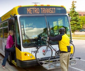
On to Transit. Now all I need to do is figure out how many bus stops are within 1/2 mile of our house (we are not near rail, yet, nor a ferry) and count the number of average daily rides are offered per weekday. The MetroTransit website shows me that two bus routes are within 1/2 mile of our home. I just have to figure out the frequency, which is every 15-20 minutes during rush hours and every 30 minutes during non-rush hours. There is no service between 1 am and 5 am. By my calculations, Bus Routes 9 and 25 both have 96 trips per weekday (that includes both ways), which means the total number of transit rides equals 192! That would definitely be more than the 125 required to say that we do, indeed, have “Outstanding Community Resources,” in other words, 3 points!
Location & Linkages points so far: 9
Cumulative points: 13
Additional points needed to get to Gold: 75
